



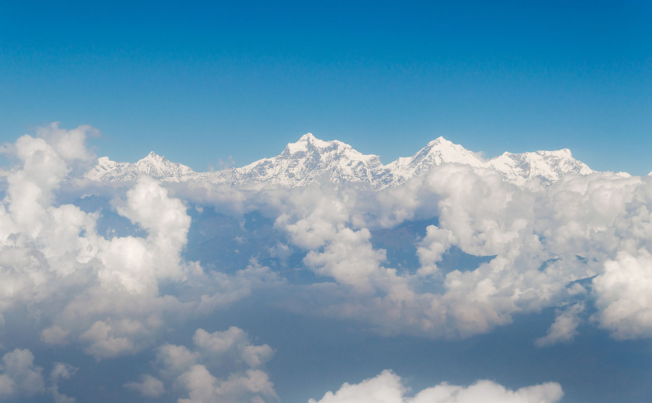
Ask any seasoned Himalayan trekker which circuit in Nepal they would walk again without hesitation, and the answer, more often than not, is the Manaslu Circuit. Not because it is the most famous - it is not. Not because it is the most accessible - it requires a restricted area permit, a licensed guide, and a minimum group size that keeps casual visitors away. But because it is, mile for mile, gorge for gorge, pass for pass, the most complete and least compromised long-distance mountain circuit in Nepal. It is what the Annapurna Circuit was thirty years ago, before the jeep roads and the guesthouses with WiFi and the morning helicopter deliveries changed the character of that magnificent route irrevocably.
Manaslu - 8,163 meters, the eighth-highest mountain on earth - stands at the centre of this circuit like a sovereign. The route encircles it entirely, passing through the gorge country of the Budhi Gandaki River, the subtropical lowland forests of the Manaslu Conservation Area, the high Tibetan-influenced plateau villages of Sama Gaon and Samdo, and over the Larkya La Pass at 5,160 meters before descending into the upper reaches of the Annapurna region. Along the way it passes through some of the most diverse terrain in the Himalayan arc - waterfalls, glaciers, ancient Buddhist monasteries, yak pastures, rhododendron forests, and high-altitude desert plateau - in a single continuous journey that takes 14 to 18 days and leaves most trekkers fundamentally altered by what they have seen.
At View Himalaya, the Manaslu Circuit is the trek we recommend to experienced trekkers who want the Himalayas without the crowds. Here is what the region holds and why it earns every superlative it receives.
Getting to the Manaslu Circuit - Gorkha and the Budhi Gandaki
The Manaslu Circuit begins in the lowlands west of Kathmandu. Most trekkers drive from Kathmandu to Arughat Bazaar at 760 meters - a journey of 7 to 8 hours through the hill towns of the Gorkha district - and join the trail at Soti Khola, the formal trailhead at the entrance to the Budhi Gandaki gorge. Some itineraries begin in the historic town of Gorkha itself - the birthplace of Prithvi Narayan Shah, the king who unified the Nepali state in the 18th century - whose hilltop palace and Gorakhnath temple deserve at least a half-day before the trek begins.
From Soti Khola, the trail immediately enters the Budhi Gandaki gorge - a deep, river-carved canyon of subtropical vegetation, suspension bridges, and narrow trail carved into cliff faces above the racing white water. The lower gorge section is warm, wet in season, and dramatically beautiful - waterfalls drop from forested walls hundreds of meters above, and the roar of the river is the constant soundtrack of the first three days. The trail passes through the villages of Machha Khola, Tatopani (with its natural hot springs), Dobhan, and the checkpoint settlement of Jagat at 1,340 meters, where restricted area permits are inspected for the first time.
Through the Gorge - Deng, Namrung and the Middle Circuit
Above Jagat, the character of the Manaslu Circuit begins to change. The subtropical vegetation gives way to temperate forest, the gorge walls narrow further before opening again into wider valley sections, and the cultural markers shift progressively from Hindu lowland Nepal toward the Tibetan Buddhist highland communities of the upper circuit. The villages of Philim, Deng, and Ghap mark this transition - each one slightly higher, slightly colder, slightly more austere than the last, and each with a gompa or mani wall that signals the deepening Tibetan cultural influence as the trail climbs toward the Tibetan border.
At Namrung at 2,630 meters the first clear views of the Manaslu massif's supporting peaks - Sringi Himal at 7,187 meters and Ganesh Himal beyond - begin to dominate the horizon. From Lho at 3,180 meters - a village of flat-roofed stone houses and prayer flag lines against a sky that is noticeably darker blue at altitude - the south face of Manaslu itself appears in its full scale for the first time: a wall of ice and rock that fills the northern horizon and establishes, without any need for guidebook supplementation, why this mountain is considered one of the most formidable and beautiful of the eight-thousanders.
Sama Gaon - The Heart of the Upper Circuit
Sama Gaon at 3,530 meters is the largest and most important settlement in the upper Manaslu Circuit - a genuine Tibetan-influenced village of whitewashed houses, carved wooden windows, and a monastery perched on the ridge above the valley with a direct view of the Manaslu glacier. It is also where every trekker spends a mandatory acclimatization day before continuing higher - and where, unlike the functional acclimatization stops of other trekking routes, the day is filled with extraordinary things to explore.
The most rewarding acclimatization hike from Sama Gaon is the ascent to Pungyen Gompa - a monastery complex on the moraine above the village, reached by a steep 2 to 3 hour climb that also brings trekkers to the edge of the Manaslu Glacier and face-to-face with the north-facing ice cliffs of the mountain itself. The turquoise glacial lake of Birendra Lake - also accessible from Sama Gaon - sits in a glacial bowl at 3,500 meters and reflects the surrounding peaks in its ice-cold water on calm mornings. The walk to Manaslu Base Camp at 4,800 meters is another option for the most fit and well-acclimatized, adding a 6 to 7 hour round trip that brings the scale of Manaslu's south face into visceral, overwhelming proximity.
Samdo, Dharmasala and the Larkya La Pass
Above Sama Gaon, the trail climbs through the high pasture settlement of Samdo at 3,875 meters - a cluster of stone buildings that operates seasonally as a trading post and yak herding base - before reaching the final teahouse before the pass: Dharmasala (also called Larkya Phedi) at 4,460 meters. This is the high camp for the Larkya La crossing, and most trekkers arrive here by early afternoon, eat, rest, and prepare for a pre-dawn start the following morning.
The Larkya La Pass at 5,160 meters is the defining moment of the Manaslu Circuit - a long, demanding climb from the high camp in the dark, crampons on ice and snow in the pre-dawn cold, followed by the pass itself: a wide, wind-swept saddle with views of Himlung Himal, Cheo Himal, Kangguru, and the entire Annapurna massif spread across the southern horizon. The descent from Larkya La is steep, long, and knee-testing - dropping over 1,500 meters to the valley floor at Bimthang at 3,590 meters. Bimthang, with its yak pastures, apple orchards, and direct views of Manaslu's west face, is where most trekkers collapse with a mixture of exhaustion and elation at what they have just accomplished.
Below Bimthang, the trail descends through the villages of Tilje and Dharapani, where it meets the Annapurna Circuit trail at 1,860 meters - either ending the trek here or continuing west toward Besisahar and Pokhara for those combining both circuits.
The Tsum Valley - The Hidden Sacred Valley
Branching north from the main Manaslu Circuit near Philim, the Tsum Valley is one of the most culturally extraordinary side journeys in all of Nepal - a self-contained hidden valley of ancient Buddhist monasteries, sacred pilgrimage sites, and one of the most intact traditional Himalayan communities on earth. The Tsum people - of Tibetan origin, speaking their own distinct dialect - practice a form of Buddhism so rooted in pre-modern tradition that scholars travel here specifically to document practices that have disappeared elsewhere in the Himalayan world.
The main Tsum Valley trek passes through the villages of Chhekampar and Nile before reaching the two great monasteries of the upper valley: Rachen Gompa - a nunnery of extraordinary antiquity with elaborately painted interiors - and Mu Gompa at 3,700 meters, the spiritual centerpiece of the Tsum Valley and home to a community of monks who follow a daily ritual practice that has remained essentially unchanged for centuries. The valley is enclosed on three sides by the peaks of the Ganesh Himal range and the Tibetan border ridge, giving it a quality of seclusion that few Himalayan valleys can match. Tsum Valley requires an additional restricted area permit and adds 8 to 10 days to the main Manaslu Circuit itinerary.
The Manaslu Conservation Area
The entire circuit falls within the Manaslu Conservation Area - a protected area of 1,663 square kilometers established in 1998 that spans five ecological zones from subtropical to nival (permanent snow). It is one of the richest wildlife habitats in Nepal, providing sanctuary for the snow leopard, red panda, Himalayan tahr, blue sheep, musk deer, grey wolf, and over 110 species of birds including the Himalayan Monal, blood pheasant, and bearded vulture. The rhododendron forests between 2,000 and 3,500 meters on the circuit's mid-sections are among the finest in Nepal and blaze with colour throughout April and into May.
Trekking Manaslu with View Himalaya
The Manaslu Circuit's restricted status means that every trekking group must be accompanied by a licensed guide - no independent trekking is permitted within the restricted zone. This is not a bureaucratic inconvenience. It is the structural reason the circuit retains the character, quietness, and cultural integrity that makes it exceptional. View Himalaya arranges the Manaslu Restricted Area Permit, the Manaslu Conservation Area Permit, and the TIMS Card for every client, and assigns locally knowledgeable guides from communities that understand the circuit not as a product but as a homeland.
Standard Manaslu Circuit itineraries run 14 to 16 days from Arughat to Dharapani. Combined Manaslu-Tsum Valley itineraries take 18 to 22 days. Combined Manaslu-Annapurna Circuit itineraries - one of the finest long-distance trekking combinations in Nepal - run 22 to 28 days and traverse two complete Himalayan massifs end to end.
The Manaslu Circuit is the trek that reminds you why you came to Nepal in the first place. Come before it changes.